Advanced 3D Solutions for the AEC Industry
At ID360 Media, we provide cutting-edge 3D scanning, Matterport virtual tours, and aerial drone imaging to enhance precision, collaboration, and efficiency for architects, engineers, and construction professionals.
Whether revitalizing historic structures or verifying new construction, our scanning services capture millimeter-accurate data that integrates into your BIM workflows effortlessly. Say goodbye to guesswork, reduce on-site visits, and make confident, data-driven decisions.
Our Services
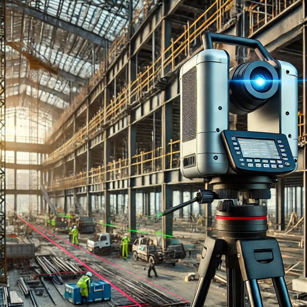
3D Laser Scanning
Read More +3D laser scanning is a technology used to capture the shape and details of objects, environments, or structures in high precision. It uses laser beams to create a digital representation of a physical space, generating a point cloud that can be used for measurement, analysis, and modeling.
3D Showcases
Read More +Our corporate philosophy at ID360 Media is to provide our state-of-the-art 3D scanning service at the lowest price points possible. Therefore, we do not provide “standard pricing” or list pricing based on area scanned. Often, large spaces with fewer rooms can be scanned as quickly as smaller ones with more rooms. Contact us and request a quote for the property!
2D Floor Plans
Read More +We have several options for producing quality, detailed 2D floor plans such as those depicted here. If you have also purchased a 3D Showcase, we can use the data from the scans to generate a precise 2D Floor Plan. This does not require any additional on-site work.
HDR Photohraphy
Read More +We create a dimension that converts. The typical internet shopper is moving too fast to catch the essence of a property when using standard photography. HDR gives them more and has them stopping to look! Rooms come alive with HDR photography.
Video Services
Read More +Videos tell a property’s story. They knit several perspectives together in one coherent presentation. At ID360 Media, we tailor each video presentation to the unique aspects of every property, keeping in mind the desired length, the intended audience and the client’s budget.
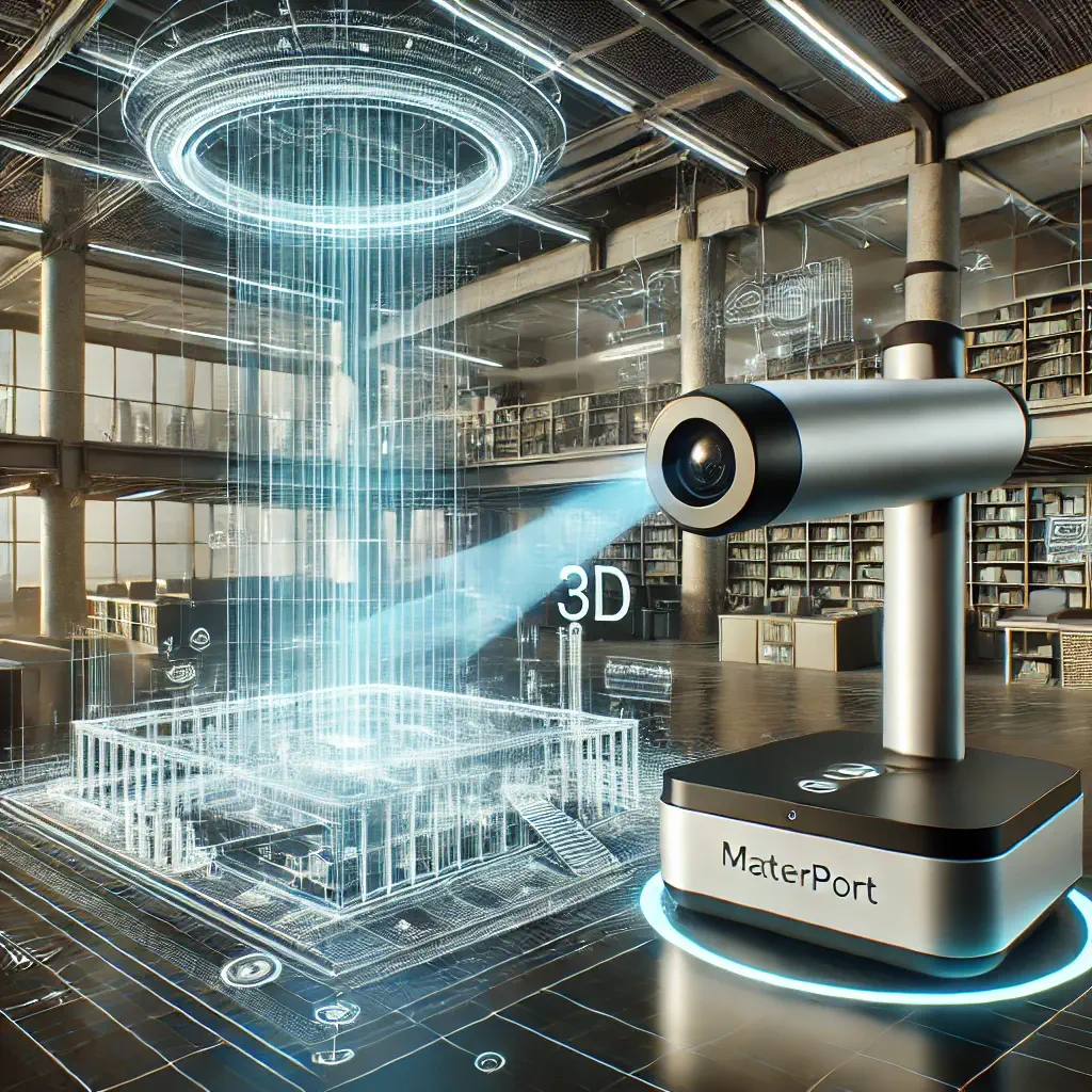
Matterport 3D
Read More +Using Matterport's 3D cameras and AI-powered software, users can capture immersive, high-resolution 3D models of homes and buildings.
Google Street View
Read More +Id360media creates high quality 360 degree virtual tours of your business. We are certified by Google and part of the Google Trusted Photographer program. While our focus is on Id360media, we provide service across the metro area.
Premium Property Marketing
Read More +This shows off the property in relation to the street its on and the neighborhood. This gives them another perspective that typical media can’t offer!
Why AEC Professionals Choose ID360 Media
High-Precision 3D Laser Scanning
Capture detailed as-built documentation with millimeter accuracy. Reduce costly errors and rework with precise measurements. Generate point clouds, CAD models, and BIM-ready data.

Virtual Site Access & Collaboration
Explore sites remotely with Matterport 3D Tours. Improve communication between stakeholders with immersive digital models. Enhance workflow efficiency with 360-degree site documentation.
Construction Progress Monitoring
Track project development with high-resolution drone imaging. Ensure quality control and compliance with aerial and 3D scans. Detect issues early, reducing project delays and cost overruns.
Digital Twin
Technology
Create virtual replicas of buildings and infrastructure. Optimize facility management and future renovations. Improve asset tracking with real-time data integration.
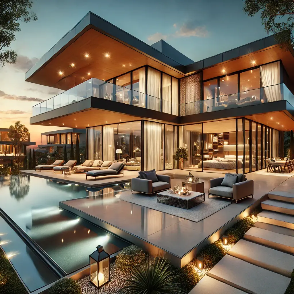
Stunning 3D Visualizations & Marketing Content
Showcase designs with photo-realistic 3D renderings. Enhance client presentations and investor pitches. Elevate your marketing with interactive 3D experiences.
Industries We Serve
Architects & Designers
Bring designs to life with hyper-realistic 3D visualizations.
Engineers & Surveyors
Obtain exact site conditions for seamless planning and execution.
Construction & Contractors
Improve efficiency with progress tracking and virtual site access.
Developers & Real Estate
Present projects with high-impact visuals that sell.
Facility & Property Managers
Optimize long-term management with digital twin integration.
What Makes Us Different?
Customized
We understand that every project is unique. Hence, each model is tailored to meet your needs and BIM Standards.
Complete
Piece by piece, we virtually build your project from the contract documents and laser scan data. No detail is being omitted.
Parametric
Parametric content is developed to be used throughout the lifetime of the project.
Accurate
Our models can be used for fabrication or field layout.
Functional
We assemble dimensional accurate as-built models, while maintaining full usability of the content.
Reconciled
Design errors and omissions are reported early, so you can have reconciled drawings before information is needed in the field.
ID360 Media 3D Scanning Advantage
1
Gather millions of precise measurements in just hours.
2
Achieve sub-millimeter accuracy for unmatched detail.
3
Gain a complete 3D spatial perspective.
4
Seamlessly share and collaborate
via the cloud.
5
Capture every detail comprehensively
in a single session.
Comprehensive 3D Laser Scanning Solutions for Accurate Existing Building Documentation
Accurately capture your building’s conditions with ID360 Media state-of-the-art 3D laser scanning, Matterport tours, CAD drawings, drone surveys, and floor flatness/levelness assessments. Our precision-driven solutions are customized to meet your needs.

Scan to BIM
ID360 Media provides advanced Scan to BIM services, utilizing state-of-the-art technology to transform point cloud data into precise Building Information Models (BIM), streamlining planning, design, and construction with accuracy and efficiency.

CAD Drawings
ID360 Media offers expert CAD Drawing services, leveraging industry-leading software and precision-driven techniques to convert raw data into highly accurate, customizable drawings—ensuring seamless project execution and collaboration.

Point Cloud
ID360 Media provides cutting-edge Point Cloud services, utilizing advanced scanning technology to capture highly accurate spatial data, enabling seamless project visualization, in-depth analysis, and informed decision-making.

Geospatial / Terrestrial Mapping
ID360 Media delivers cutting-edge geospatial and terrestrial mapping solutions, utilizing advanced technology to capture and analyze terrain data with precision. From urban planning to environmental assessments and infrastructure development, we empower clients with actionable insights for confident decision-making.
Frequently Asked Questions

Client Testimonials

Worked with id360 on a recent tour for a factory. They were wonderful. Very responsive, fairly priced and high quality work. Highly recommend them.
Film P

They shot a virtual tour of my entire campground. The shots were amazing, it helped my online presence. They were very professional and knowledgeable.
Phil M
Very professional, outstanding work. I would not even consider using anyone else. They are very responsive to questions and work well with my sellers.
Lacie M
100+ Projects Successfully Delivered
10,000,000
Sqft Modeled
10,000,000
Laser Scanned
Book A Consultation
Discover how ID360 Media can elevate your projects with next-gen 3D technology